Europan 13: the adaptable city

Lines and Marks in nature

Europan 13: the adaptable city

Lines and Marks in nature

[ IT ]

La città di St Pölten si trova nell’area geografica della bassa Austria. Nata originariamente come “città minore” e sviluppatasi ulteriormente in seguito alla costruzione della rete ferroviaria che collegava Vienna al resto dell’Europa, è oggi la città principale della regione, con contesto architettonico, culturale e infrastrutturale di alto livello.
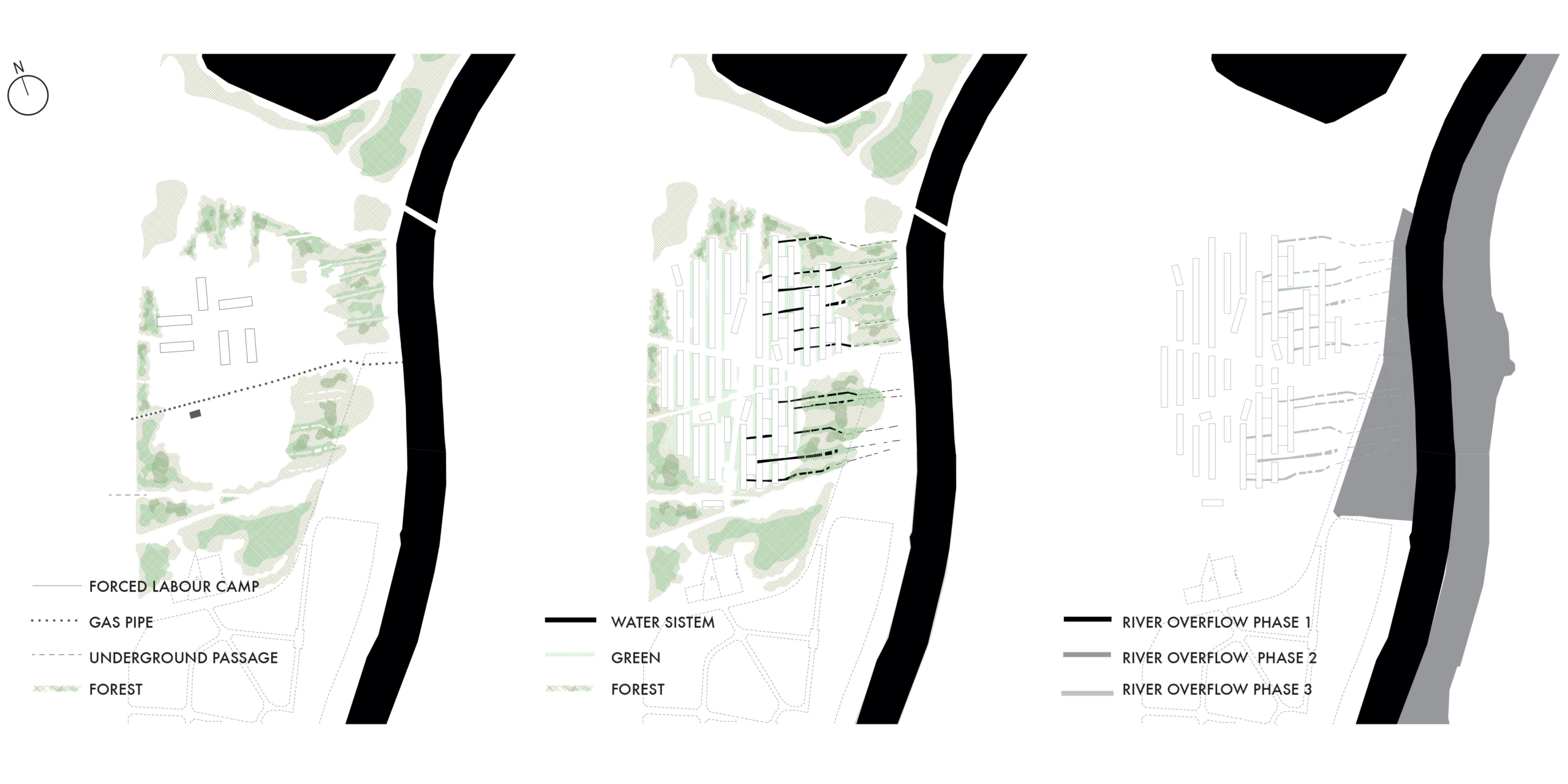
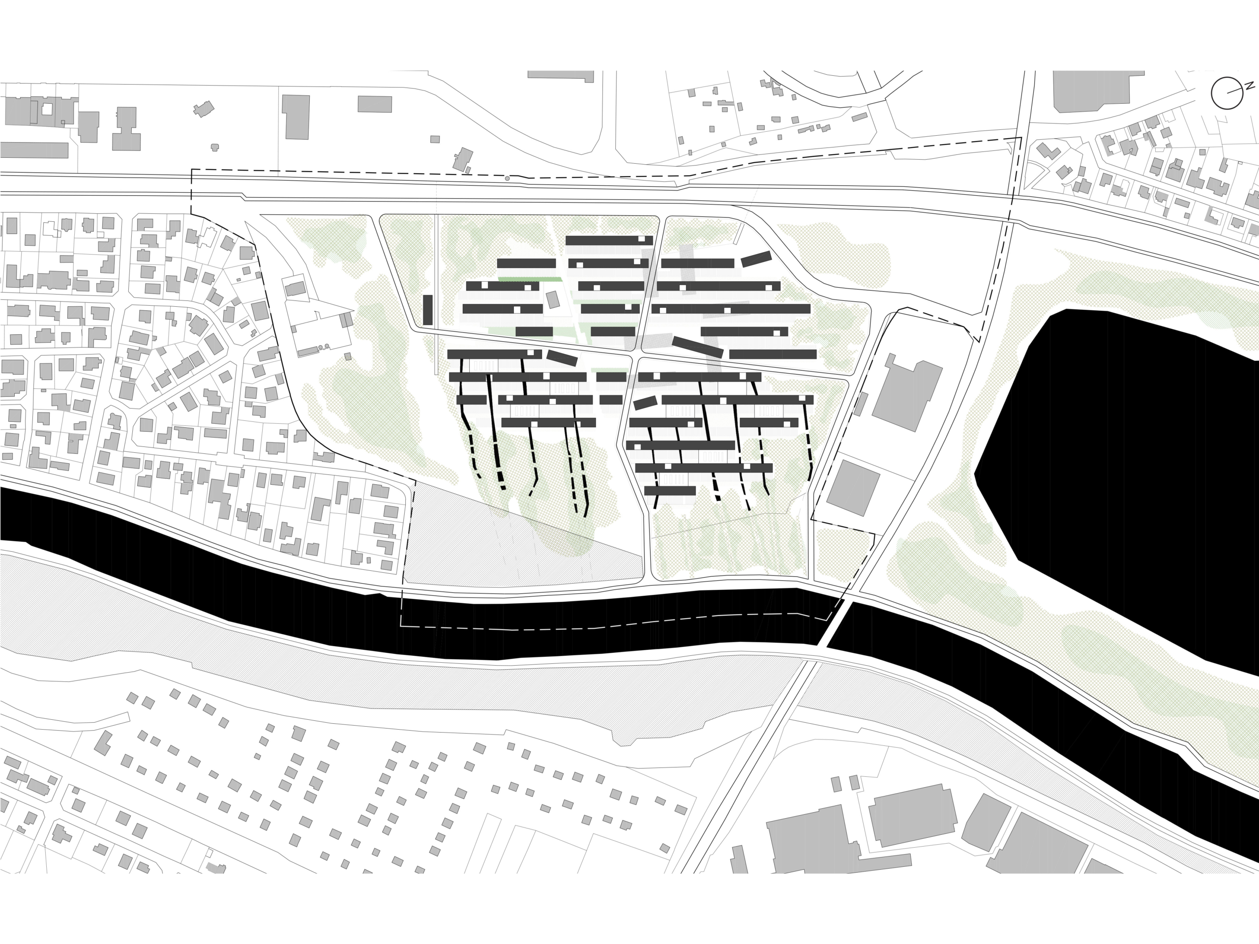
L’analisi della struttura territoriale dell’area urbana della città ha fatto emergere una serie di elementi chiave capaci di generare nuove modalità nella progettazione su scala paesaggistica. All’interno dell’area strategica definita nel bando di concorso, le principali componenti territoriali individuate sono state: gli elementi d’acqua come il fiume Traisen, che definisce il confine sul lato Est, e lo stagno artificiale (i quali si configurano come luoghi della memoria); tutta la rete verde composta da boschi e campi agricoli; gli elementi antropici della ferrovia e la rete stradale sul lato Ovest. Ciò che maggiormente ha influenzato la storia di quest’area è la presenza dell’ex struttura del campo di lavoro forzato costruito nel 1942.
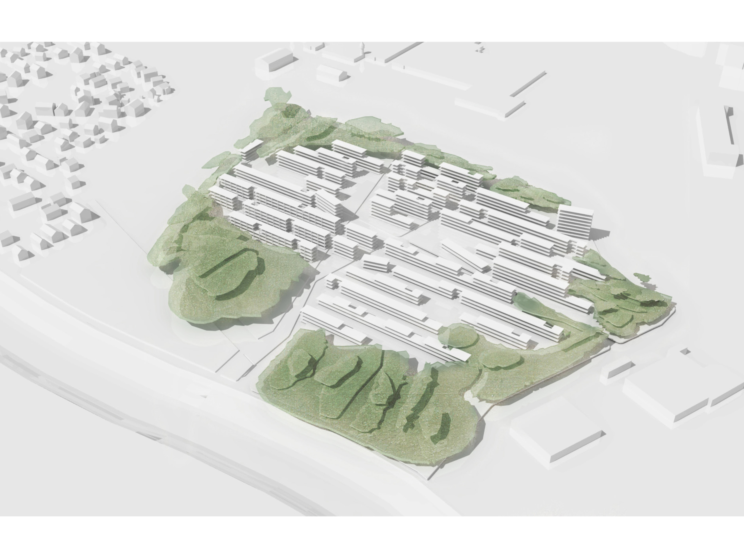
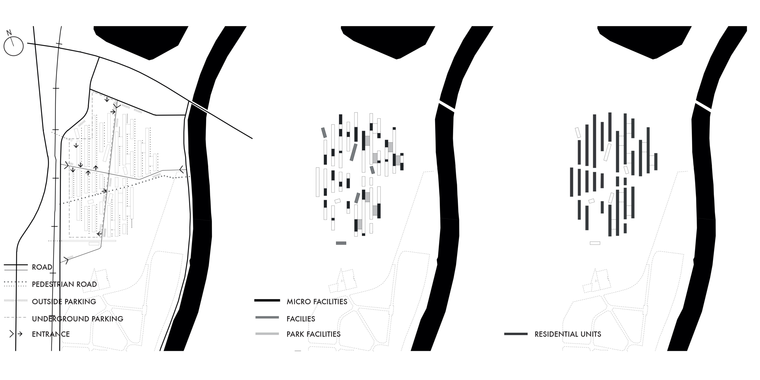
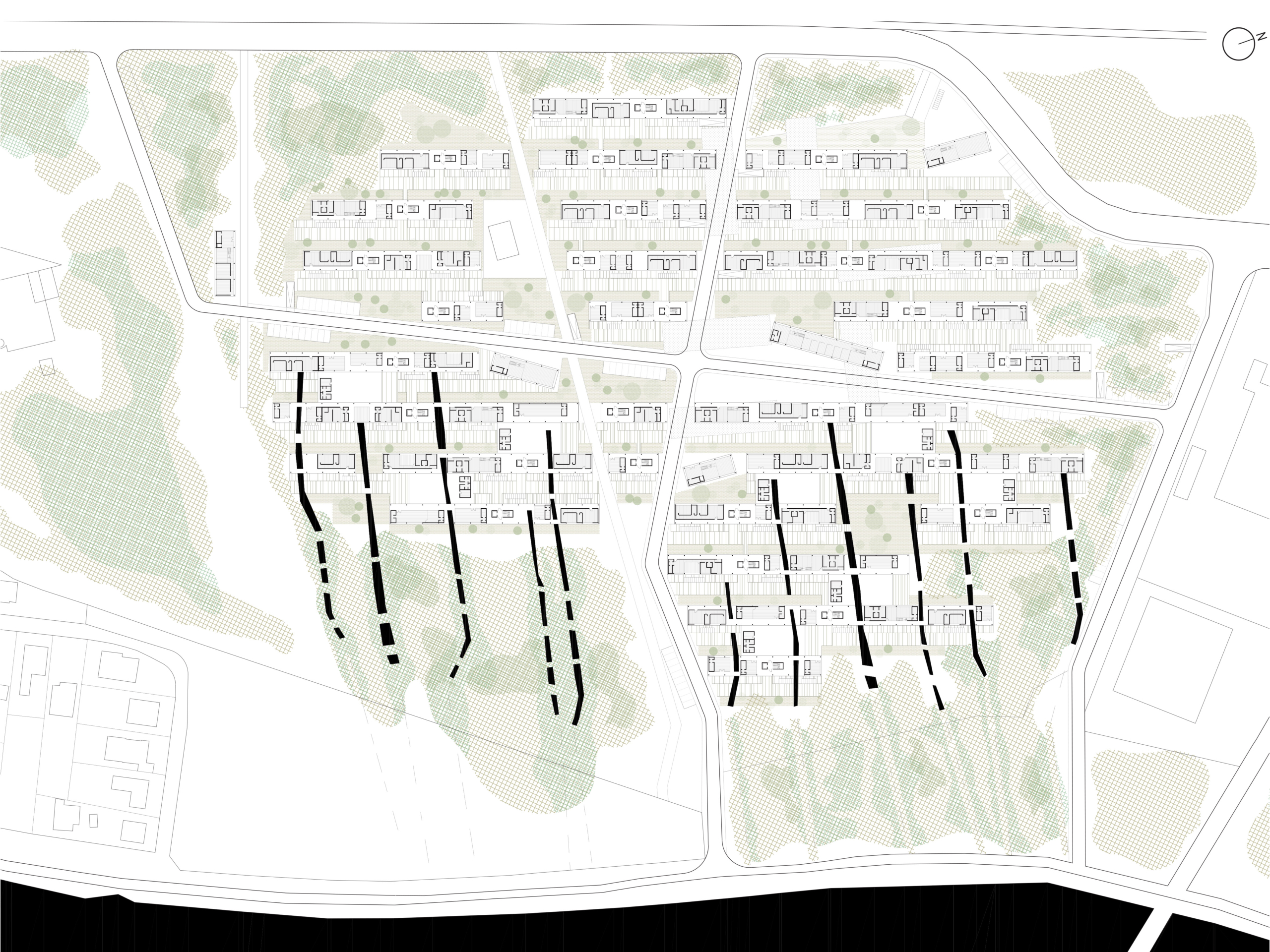
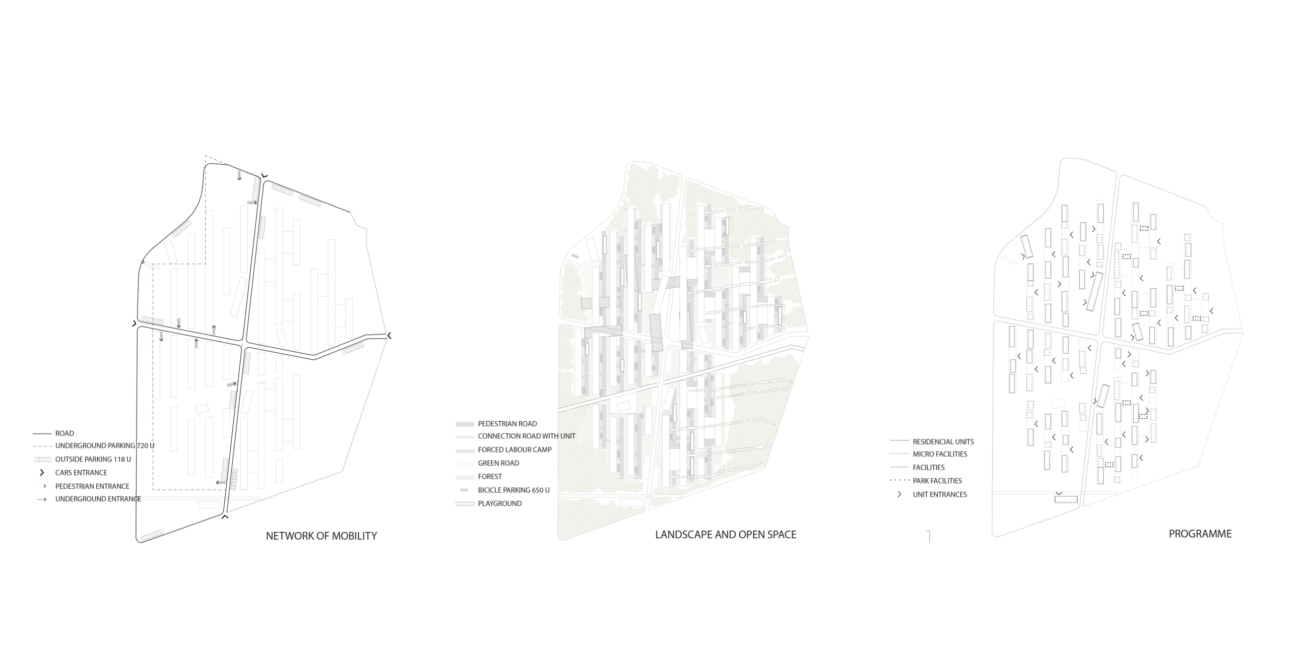
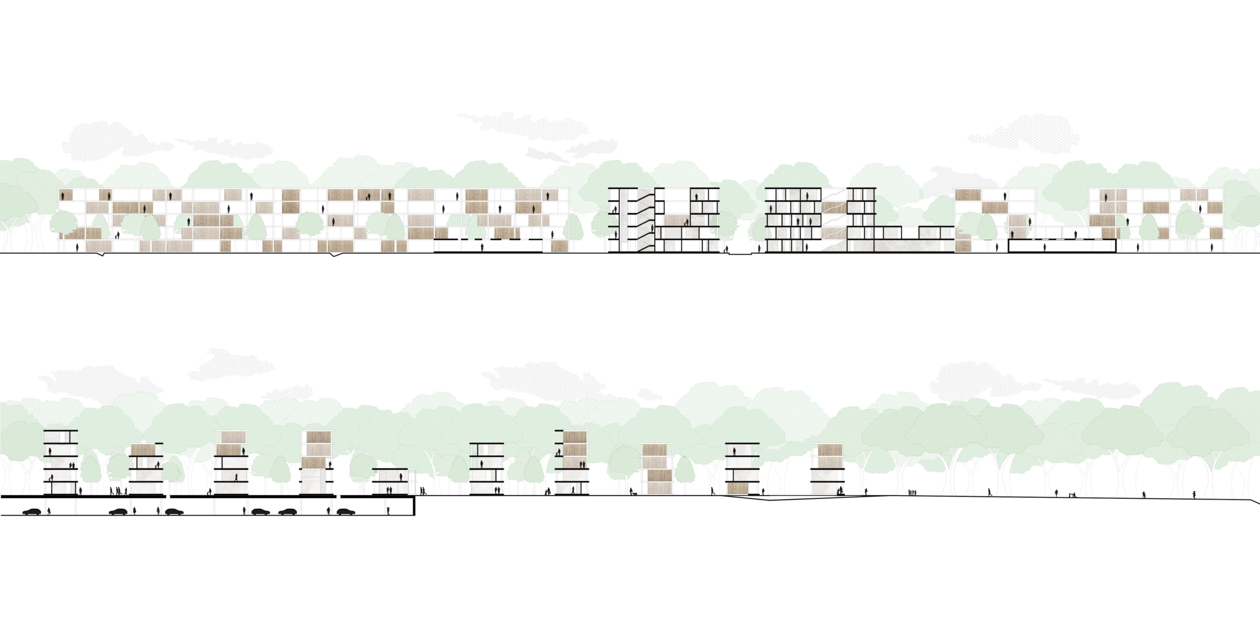
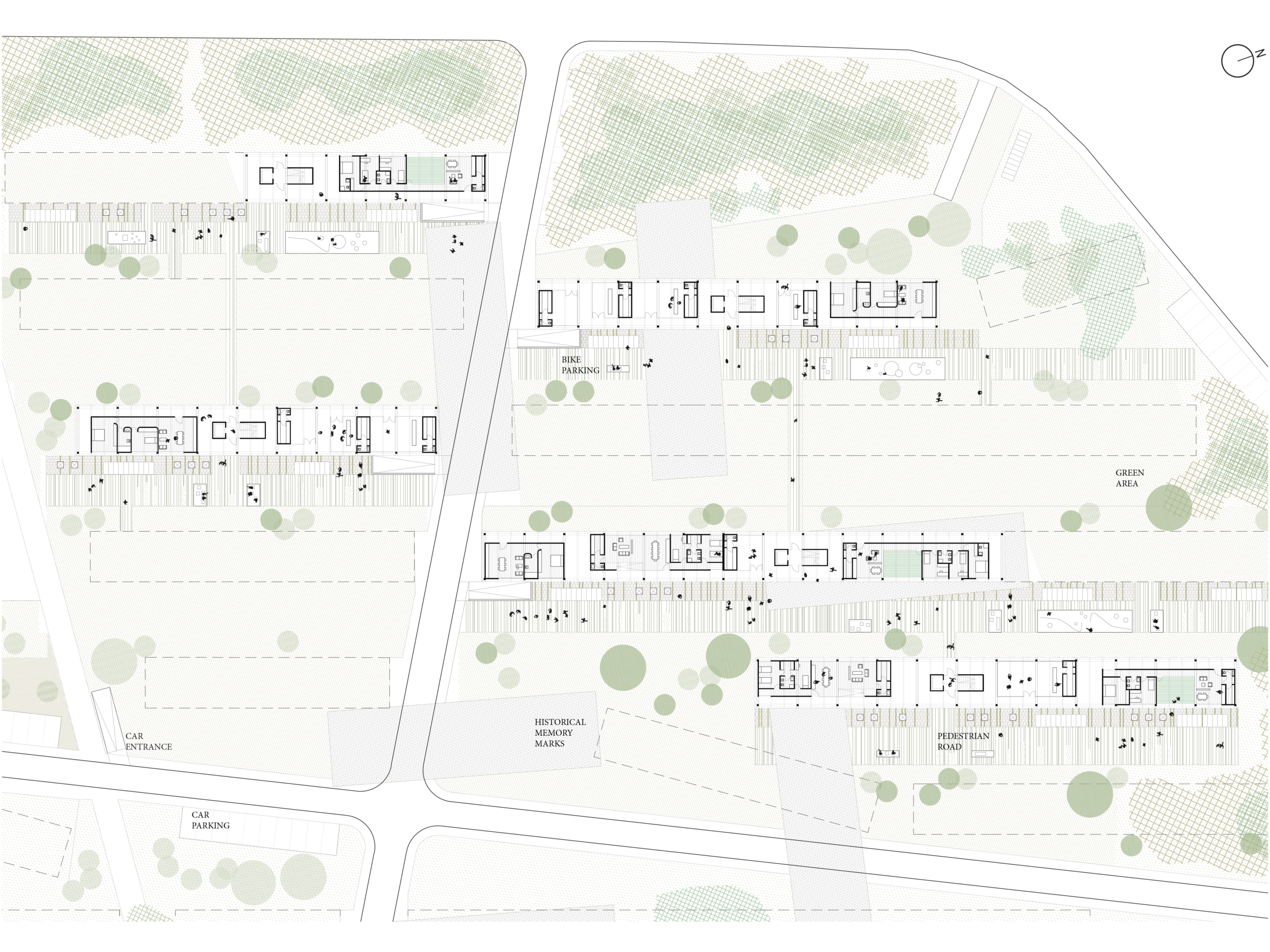
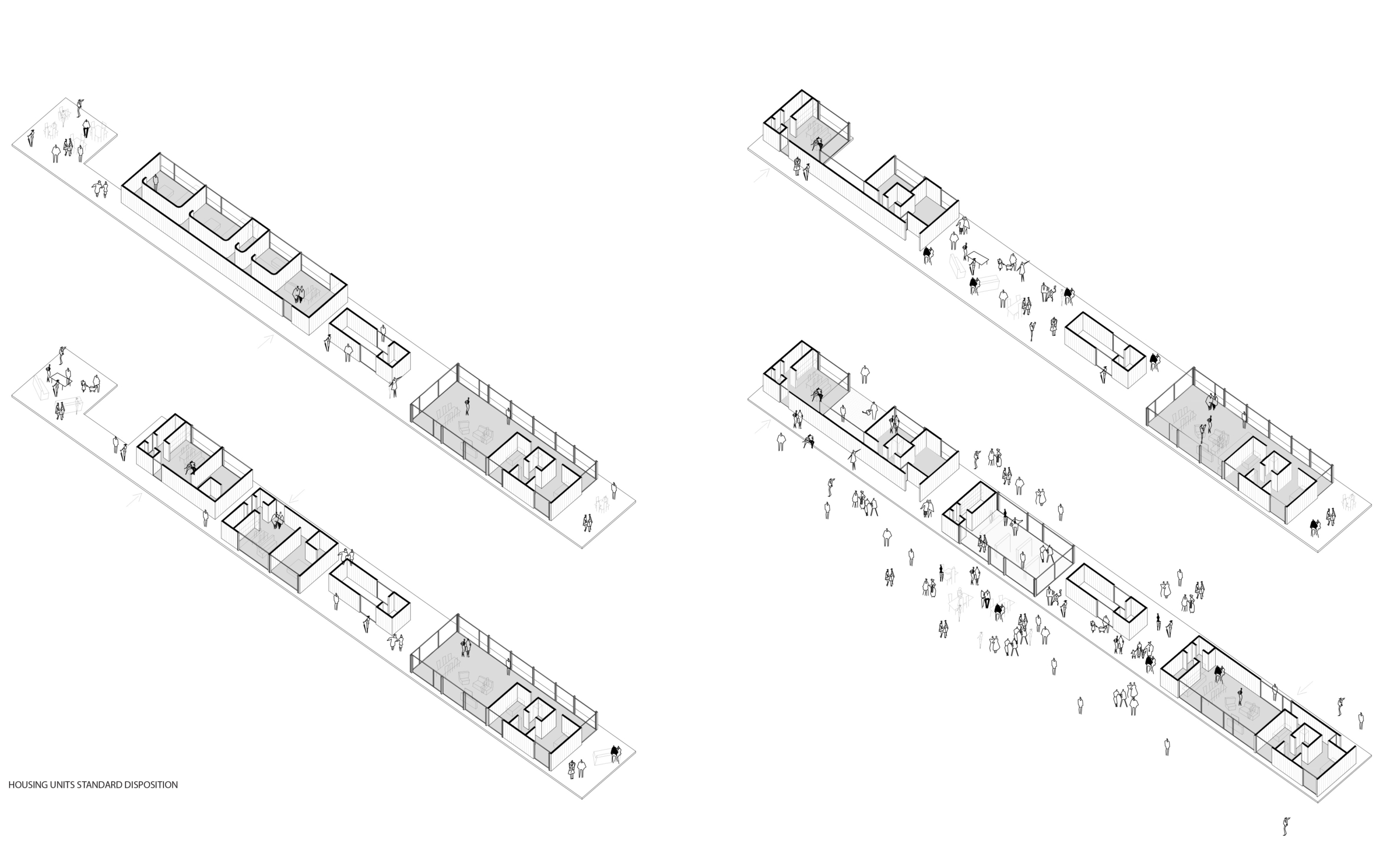
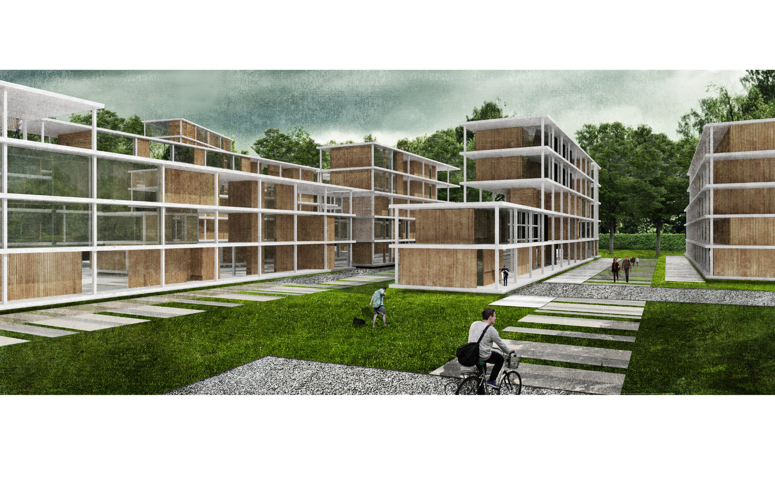
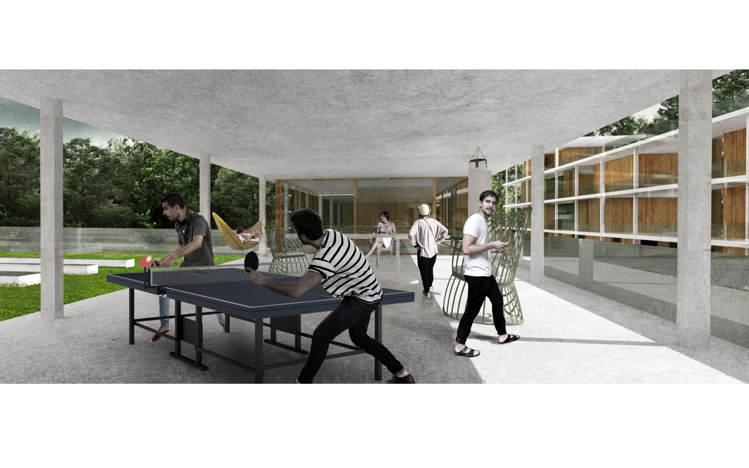
Nella proposta progettuale, questa ferita all’interno dell’area è stata presa in considerazione, convertendola in un segno che dà forma gli spazi delle unità abitative nell’area verde. L’obiettivo del progetto è di creare una rete naturale e abitativa capace di inserirsi e alimentare il sistema di interazioni tra la scala territoriale e quella urbana. L’intera proposta mette al centro delle scelte progettuali la qualità della vita e il rispetto dell’ambiente, sia a nella scala urbana che in quella architettonica.

[ EN ]

The city of St. Pölten is located in the geographical area of the low Austria. Originally born as a minor city and further developed after the construction of the railway linkin Wein to the rest of Europe, today it is the maintown of the region and a city at the top in the architecture, culture and infrastructure.
By analizing the territorial structure of St Pölten municipal area, a range of key elements, able to generate new approaches in the landscape design, emerges. Within the strategic area defined in the Europan competition, the main territorial components have been pointed out: the water elements such as the Traisen river, which defines the East side border, and the artificial swamp (both acting as places of  memory); all the natural net consisting of woods and agricultural fields; the artificial components of the railway and the road net on the ovest side. What most influenced historically this territory is the presence of the former Forced Labour Camp built in 1942.
In the project proposal this wound in the area has been taken into account by converting it in a sign which shapes the space of the housing units in the green area. The aim of the project is to create a natural and housing net able to work together and give energy to the system of relations acting between the territorial and urban scale. The whole proposal puts at the centre of the project choises the quality of the life and the respect for the enviroment, both on the urban and architectonical side.

    St Pölten [A]

    69.440 m²

    2015

    competition project

    with: – con:

studio LERUA

arch. Annamaria Gaito

arch. Antonio Cugusi

    competition project

English text →

The city of St. Pölten is located in the geographical area of the low Austria. Originally born as a minor city and further developed after the construction of the railway linkin Wein to the rest of Europe, today it is the maintown of the region and a city at the top in the architecture, culture and infrastructure.
By analizing the territorial structure of St Pölten municipal area, a range of key elements, able to generate new approaches in the landscape design, emerges. Within the strategic area defined in the Europan competition, the main territorial components have been pointed out: the water elements such as the Traisen river, which defines the East side border, and the artificial swamp (both acting as places of  memory); all the natural net consisting of woods and agricultural fields; the artificial components of the railway and the road net on the ovest side. What most influenced historically this territory is the presence of the former Forced Labour Camp built in 1942.
In the project proposal this wound in the area has been taken into account by converting it in a sign which shapes the space of the housing units in the green area. The aim of the project is to create a natural and housing net able to work together and give energy to the system of relations acting between the territorial and urban scale. The whole proposal puts at the centre of the project choises the quality of the life and the respect for the enviroment, both on the urban and architectonical side.
← Testo in italiano

La città di St Pölten si trova nell’area geografica della bassa Austria. Nata originariamente come “città minore” e sviluppatasi ulteriormente in seguito alla costruzione della rete ferroviaria che collegava Vienna al resto dell’Europa, è oggi la città principale della regione, con contesto architettonico, culturale e infrastrutturale di alto livello.
L’analisi della struttura territoriale dell’area urbana della città ha fatto emergere una serie di elementi chiave capaci di generare nuove modalità nella progettazione su scala paesaggistica. All’interno dell’area strategica definita nel bando di concorso, le principali componenti territoriali individuate sono state: gli elementi d’acqua come il fiume Traisen, che definisce il confine sul lato Est, e lo stagno artificiale (i quali si configurano come luoghi della memoria); tutta la rete verde composta da boschi e campi agricoli; gli elementi antropici della ferrovia e la rete stradale sul lato Ovest. Ciò che maggiormente ha influenzato la storia di quest’area è la presenza dell’ex struttura del campo di lavoro forzato costruito nel 1942.
Nella proposta progettuale, questa ferita all’interno dell’area è stata presa in considerazione, convertendola in un segno che dà forma gli spazi delle unità abitative nell’area verde. L’obiettivo del progetto è di creare una rete naturale e abitativa capace di inserirsi e alimentare il sistema di interazioni tra la scala territoriale e quella urbana. L’intera proposta mette al centro delle scelte progettuali la qualità della vita e il rispetto dell’ambiente, sia a nella scala urbana che in quella architettonica.